Pindari Kafni Trek
I had heard about trek to Pindari quite often but the impression, I had got was such that I did not do it for long. Well, I think, I was a fool. I was going to Gangotri again and again for Auden’s col which was not falling in place because of problems being faced by my partner on the home front. So, after successful completion of Auden’s col trek I moved to Kumaon for trekking with another partner. This brought both of us to Bageshwar where we had planned to meet. While on Auden’s col trek, Dewan had told me about the Pindari – Kafni trek and as such I decided to give it a try. Dhami reached Bageshwar from Jalandhar via Delhi and Kathgodam and I reached from Pauri where I had gone after my earlier trek for few days rest. The Manager at the KMVN’s tourist rest house at Bageshwar was quite helpful and provided us with the necessary information. He told us that the guides keep coming to the rest house and we may be able to get one. However, in absence of any guide reaching Bageshwar we got a list of guides and next day moved on to Song, which is 40 kms away. The road has moved upto Loharkhet which is above Song, at a distance of 04 kms. At Song we launched our search for Golu who was first on preference list. However, all efforts of Pushker who was second on list failed to find Golu, though he had been sited some time before our arrival. Not too keen to waste our time in the small Song we struck deal with Pushker.
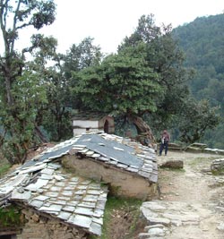
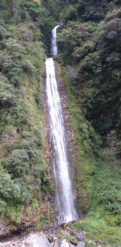
No vehicle was moving to Loharkhet and so we decided to trek the four kms. With Pushker leading the way we reached the fresh water point after 500 meters and stopped there for changing gear. Suddenly, one young lad came running up and Pushker introduced him as Golu. Having heard that some one was looking for him he had come behind us. Since we had moved on the trail with Pushker we did not want to let him down. Both of them also spoke and it was decided to continue with Pushker. The sun was out in full strength on us, with clouds seen at a distance. It was quite hot. We moved up along the cemented path which was moving through the village. We hit the road and again took shortcuts to reach KMVN’s TRH at Loharkhet. The TRH is located much above the village and has good view of the valley. After lunch we moved on though the guide wanted us to stay there. The black clouds were moving in slowly. The broad trail was laid with stones and was well maintained. We reached the temple located just next to the trail and sat in the shade of big trees there. The trail continued to move up and we took shortcuts suggested by Pushker. He showed us the place upto which we were to climb before going down on the other side. Stopped for tea by a small shop and enjoyed the scenery. The gathering black clouds made us to move up and on the final climb we were caught by rain. Dhami’s rain gear was out and we reached the Dhakuri Pass while it was still raining. Tried to get signal on our mobiles but failed. It had become slushy and we moved on towards the Dhakuri camping ground located one km from the pass. We sighted it just for a second from top and then it was again out of site. The rain stopped as we reached the camping ground. It was lovely, though crowded. Pushker wanted us to move into one of the hotels but we reminded him that we had taken him for carrying the big tent we were carrying and not for leading us. With this the things settled and the tent was pitched next to the memorial and all our items moved in. Had our food at the hotel, enjoying the kitchen fire. The rain had started again and we moved in for the night, which was continuously disturbed by the bells tied to the horses, who have been left loose for grazing.
We left the hut at 1500 hours and reached a spot where the stream coThe view of the snow covered peaks in distance made us rush outside at the break of the day. The rain had stopped and sky was clear of clouds. The Nanda Kot, Maiktoli and Pawali Dwar peaks were dominating the sky line. All other trekking parties had started to leave and we took time in enjoying the Dhakuri ground and left the place after a heavy breakfast at the local tea shop. The trail moved down toward the last village of the valley. Pindar river was flowing to our left somewhere deep in the valley. Well, the walk was over well laid path. We were moving on one of the earliest trekking trails of the area and as such there was no problem. Much before lunch we reached the last village of Khati. We were thinking of reaching Dwali by evening after having lunch at Khati but we had reached much before lunch time and so decided to take rest and have tea at the hotel located just next to the trail. The KMVN’s TRH was located a bit ahead above the village. Just thereafter, the trail had been washed away by massive landslide and we had to take quite a detour. The river was flowing down and slowly we started moving towards it and finally we were at the same level. Some distance away the other parties which had left much before us were resting at the way side tea shops. We also stopped there for tea and saw the destruction done by the river at this particular place, where it changes course during the rains. Immediately after the shops the trails move to the right bank of the Pindar river and moves along the river much at a level ground. The Inspection bungalow and two tea shops were soon seen across the river. We had reached Dwali which is located at the site where the Kafni and Pindar rivers meet. The KMVN’s TRH was located a bit above. The weather was clear and we immediately sat down for late lunch. The tent was pitched and we decided to visit Kafni next day and spend the night again at Dwali. So we had moved from Dhakuri to Dwali via Khati, a distance of 22 kms.
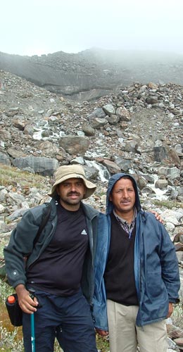
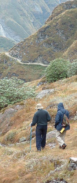
After heavy breakfast we were on the trail moving towards Kafni glacier. The trail moved behind the TRH and along the Kafni river which was on our right. The trail slowly started to climb up and it was covered with wild shrubs as it is not as frequented as the Pindari trail. The trail was easy but narrow. We reached the rest house built by the village panchayat at about 07 kms from Dwali. A chowkidar was here who mans the place during the season and doubles up as a cook. The weather was fine though the clouds were gathering in sky. Nanda Kot was single handedly dominating the valley, as Kafni is located below it. We were overtaken by its closeness and beauty. After tea and ordering our lunch we left the place for the glacier. The scenery opened out and the trail continued to move up to wards our destination. I was looking for an open ground with huge stones which I had seen in the pics of the place, though all around it was beauty. By the time we reached the snout of the Kafni glacier the clouds had engulfed Nanda Kot and we missed what would have been excellent photos of the place. We were late in reaching the place. It would have been better to stay there for a night and enjoy the place than rushing from Dwali. It was threatening to rain and so we took photos of the glacier and turned back. It started to drizzle as we reached the open ground with big stones which from vantage point looked much more beautiful and I was able to make out the pic I had seen in the book. As we crossed the ground it started to rain heavily and we got completely wet. I cursed myself for only carrying the upper half of the rain gear. Well soon we were back at Khatia where our lunch awaited us. So we were out of rain and that was a big relief. After good lunch and rest we left the place for Dwali. The rain had stopped and so it was not much problem other than walking in wet clothes. Two hours and by early evening we were back at Dwali and into dry clothes. Today we had done 22 kms, though without our sacks and it had been good except the last moment absence of Nanda Kot when we reached the glacier.
Today we had only 11 kms to do and so we were not in much hurry. The Nanda Devi East was looming at the head of the valley and it gave us company for quite sometime. The trail was broad, well laid and moved up and up till we reached Phurkia, where the last KMVN’s TRH of the trail is located. Two shops also exist at this place. A quick cup of tea and we were on our way again. The trail now moved up at a much gentle pace and the view started to open up a bit. Another 5 kms and sign of human existence came into view down in the open plain. Finally we reached the Baba’s ashram. Zero point is still 01 km from this place. We pitched our tent and had hot food at the Ashram. Still lot’s of time was at hand and we decided to go to the zero point. The trail crossed a small stream and climbed slowly towards the zero point which we reached without any problem.
Oh! what a place to be at. The zero point gives you view of the Pindari glacier and the Traill’s pass above it, from quite a distance. Unlike Kafni glacier snout it is not possible to reach Pindari glacier snout. The drop from zero point onto the river is quite a bit and it is truly dangerous. No jumping around at this place. The view is stunning. I was cursing my self for not carrying the zoom lens, which I had left at Bageshwar to reduce the weight of the sack. We were standing in front of the Nanda Devi sanctuary’s outer wall. Starting from our left as we stood facing the glacier at zero point were Panchail group, Baljori (rocky), Panwali Dwar (conical), Nanda Khat (Three peaks), Traill’s Pass, Changouh (big one) and Nanda Kot (just visible) peaks. I could not stop taking pictures of these peaks about which I had read so many times. We came back to the Ashram for tea and there got into discussion with Babaji. He told us about the place and of his hut at a height of 16000 ft where he goes for meditating. He told us about the views of Nanda Devi east and west which you get from there and also about the route to Munsyari from this place, of which I had never heard off. Though I did not have time, I wished to have a closer look of the Traill’s pass and of the Nanda Devi peaks. I decided to getup early next morning and go on the trail which takes you to the camp I.
Next day I was up and about before sunrise. It was very cold but the will to take a look of the glacier and the Nanda Devi kept my sprits up. I reached the part of the trail where I had seen the path moving up on the side of the mountain. The narrow trail moved up and I started to get vantage views of the surrounding places. Slowly the peaks were turning golden according to their height. Dhami had by this time moved to the Zero point for photography, which he did not find great for early morning photos. Camp itself would have been great. The path was not well defined now for me and I just kept moving up and up. The dew was frozen and at places it was slippery. I was now at 4000 meter and Nanda Devi east was slowly coming into view. We had decided to reach Khati that day by evening and so it was time for me to turn around. I missed the view of both the Nanda Devi peaks, for which I had moved ahead of Ashram. Keeping it for next time, I turned around and reached Ashram for some heavy breakfast. While I enjoyed breakfast, Dhami packed up the camp and we left the Ashram with a desire to comeback for the trek to the area ahead.

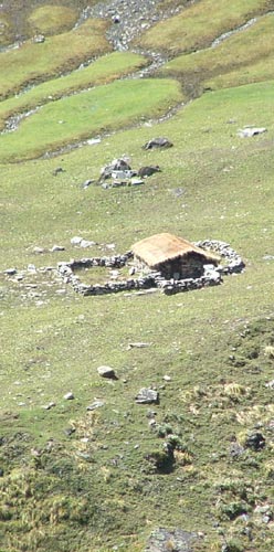
Now we were moving down and so it was fun all the way. We stopped for tea at Phurkia and reached a deserted Dwali for lunch. Only two tea stall owners and the chowkidars of the TRH were there. We had a quick lunch and moved off towards Khati. We reached Khati as sun was setting down and settled down for night at the wayside lodge where we had stopped for tea on our way up.
Next day we left Khati early morning and with Maiktoli giving us company reached Dhakuri for breakfast, which was again lying deserted. The climb up to Dhakuri was uneventful but this time we got the signal on our mobile and so contacted home front immediately. As we were moving back and sun was out in full strength, Loharkhet seemed far off. We caught the boys trekking team who were returning from Pindari and reached the KMVN’s TRH for lunch which took long time in coming. The walk down to Song was in sun and took an hour. By this time the vehicles for Bageshwar had already left. We had no desire to spend the night at Song. We waited and waited for some vehicle to move down but finally hired a complete Sumo which brought us to Kapkote. From here we reached Bageshwar by the last bus of the route. Back at the TRH we saw discussions taking place about the route and guides having reached the bungalow to escort their clients on the trail to Pindari. People moving up were full of josh and we were content at having completed an excellent trek.
Keep The Mountains Clean

