Okhimath to Helang via Nandi Kund
As most treks in this region do, a trek from Okhimath to Helang in the Garhwal Himalaya takes the scenic route via Madhyamaheshwar, Nandi Kund, Bansi Narayan temple and Urgam. This high altitude trek, takes one over the high ranges without involving the glaciers or even snow if attempted in autumn. However, during spring and early summer, one may find plenty of snow. We reached Okhimath by afternoon and after lunch we left for Jugasu, two km of downhill walk in sizzling hot sun. Passing the village of Uniyana we reached the village of Ransi just after sunset. For the night we stopped at a hotel called Chaukhamba. Next day early we left Ransi and stopped for breakfast at Gaundhar village, which is 05 Km from Ransi. This being a pilgrim trail upto Madhyamaheshwar temple, it has many hotels providing basic food and shelter.
The climb of Madhyamaheshwar starts immediately after crossing the bridge beyond Gaundhar village. It is 09 km from here to Madhyamaheshwar at 3,990 meters. By afternoon we were at Madhyamaheshwar and settled down for the night at the Dharmasala. Next day we visited Buda Madh, a 1,000 ft or so higher than Madhyamaheshwar, to get a view of the snow-covered Chaukhamba group and Mandani Parbat. Thereafter, we entered the lush green jungle behind the temple and slowly started ascending. Soon we were in the open on a steep climb where we had to stop frequently to catch our breath. After walking – interspersed with frequent rests – we reached the Kashni Dhar at about 14,500-ft.
Next day we visited Kashni Tal, which was all the way uphill towards Chaukhamba peak and it was a 03 hours round trip from the camp. Thereafter, we were on our way down to the Pandosera grazing ground, which is visible from Kashni Dhar. However, there was no trail initially and we just kept on going down. We reached a waterfall by evening, which was a lovely place to camp, but since we had decided to reach Pandosera, we kept on moving. Reached Pandosera just before it became completely dark.
The next day brought cheers. It was a bright day with hardly any clouds. The night had been quite cold, freezing the water in the can. A brown bear was sighted by the team 100 meters from the camp, moving down from the higher reaches. We walked up the plains of Pandosera, keeping to the right. Reaching the river, we walked along its right side since it was the Madhyamaheshwar ganga which originates from Nandi Kund. We kept walking with the river on our right and kept gaining height, finally reaching Nandi Kund.
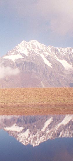
The Nandi Kund at 15,000 ft is quite a big lake and seems deep also. The Madhyamaheshwar Ganga originates from it and it is surrounded on all sides by high ridges except on the side where Chaukhamba is towering at a distance. The reflection of Chaukhamba in the waters of the lake provide an excellent photo opportunity.
The day was excellent, everything was white and the water of Nandi Kund was still and clear. The climb was gentle in beginning along the Kund. Thereafter it started to climb and involved boulder hopping and climbing up. Three hours of hard walk brought us to the Ghia Vinayak Pass at around 17,500-ft. Up to the pass it was all snow, but on the other side there was not a flake. It was a very steep slope on the other side and there was no trail. From the top a level ground down below was visible. Slowly, we reached that place. However, it was nothing but only 1/3 way down. There was now a trial visible quite down below, which split into two after some time. We took the left one and crossed the stream coming from left to reach the camping ground just across it.
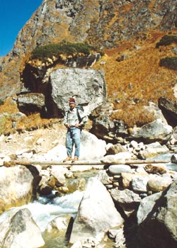
The next day was bright and clear. However, the day was meant only to climb up and more up. We moved off from the camp after breakfast and the climb to the ridge started. One ridge climbing led to a climb-down on the other side and then again a climb up another ridge. We had to get down to the valley since we were supposed to cross the Gangar Toli river. Alas, we entered a rhododendron jungle and could find no way out of the floral forest. Had to retrace steps and find the trail leading to the river. Fortunately, there was a log bridge over the river and so crossing the river was not a problem.
We had a last major climb in front of us – to the ridge on whose other side was the Bansi Narayan temple, our night-stop. We got a trail on the other side of the river and started following it. We entered the rhododendron jungle through which the trail was passing – it was a narrow trail surrounded by the impenetrable rhododendron jungle. The trail was the only place to move. Evening was approaching and this jungle had to be crossed at the earliest possible because we did not fancy meeting any wildlife on the narrow passage in the jungle. After the jungle, there were open grass slopes and by the time I reached the ridge it was 1800 hrs and sun had already set. The view of the big Himalayan peaks was in front of us. Down below we could see the trail and the abandoned remains of the Bakriwallas’ huts. Now we started moving down, away from the ridge. Finally we reached the trail and following it, reached the Bansi Narayan Temple.
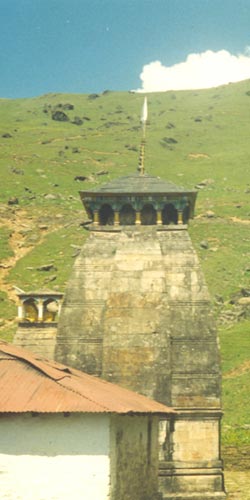
The Bansi Narayan temple is a single structure temple in front of a large slanting stone, which was being used by the Bakriwallas. No one stays at the temple since it is far from any habitation. The nearest village is half a day’s walk. The complete Himalayan range dominated by the great Nanda Devi was in front of the temple. The sun comes out from behind the peaks and so evening is the best time to get excellent photos. The Kauri pass was also visible in front of us.
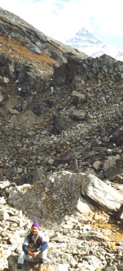
Just below the temple a trek was visible going down. However, this trek is not to be taken if one wishes to go to the Urgam village side. This trek will lead to another village and then on the Pipalkoti and it’s a longer way to reach the road head. For the way to Urgam, we had to cross the ridge just above this trek and get down into the jungle. On the other side of the ridge, there is a very good trek down the jungle. However, the jungle is thick and there are places where many treks veer off, capable of misleading trekkers. So the trekkers must bunch together, keeping each other in sight on this zigzag trek all the way down to the valley. The villages of this valley are visible from quite a distance and so we kept going down till we met a villager. He guided us to the Negi Hotel where we spent the night.
The last day of the trek started with visit to Kalpnath temple about two km from the village across the river and below a waterfall visible from the village. It is a wide footpath from the village to Helang which is 09 km away. We were on the Badrinath Srinagar road in about 03 hours.
Gallery Okhimath-Helang Part I
Gallery Okhimath-Helang Part II
Keep The Mountains Clean

